B2F-Map: Crowd-sourced Mapping with Bayesian B-spline Fusion
Abstract
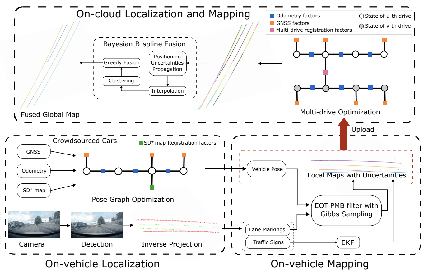
Crowd-sourced mapping offers a scalable alternative to creating maps using traditional survey vehicles. Yet, existing methods either rely on prior high-definition (HD) maps or neglect uncertainties in the map fusion. In this work, we present a complete pipeline for HD map generation using production vehicles equipped only with a monocular camera, consumer-grade GNSS, and IMU. Our approach includes on-cloud localization using lightweight standard-definition maps, on-vehicle mapping via an extended object trajectory (EOT) Poisson multi-Bernoulli (PMB) filter with Gibbs sampling, and on-cloud multi-drive optimization and Bayesian map fusion. We represent the lane lines using B-splines, where each B-spline is parameterized by a sequence of Gaussian distributed control points, and propose a novel Bayesian fusion framework for B-spline trajectories with differing density representation, enabling principled handling of uncertainties. We evaluate our proposed approach, B2F-Map, on large-scale real-world datasets collected across diverse driving conditions and demonstrate that our method is able to produce geometrically consistent lane-level maps.
Results
Let’s look at some qualitative results, lane-level HD maps from production vehicles, overlayed on google satellite images.
Bibtex
@article{xie2026b2fmap,
  title        = {$B^2F$-Map: Crowd-sourced Mapping with Bayesian B-spline Fusion},
  author       = {Xie, Yiping and Xia, Yuxuan and Stenborg, Erik and Fu, Junsheng and Beauvisage, Axel and Garcia, Gabriel E and Wu, Tianyu and Hendeby, Gustaf},
  journal      = {2026 IEEE International Conference on Robotics and Automation (ICRA)},
  year         = {2026}
}